 Welcome to our Severn Stoke Flood Bund page
Head to the bottom of this page for the latest updates.
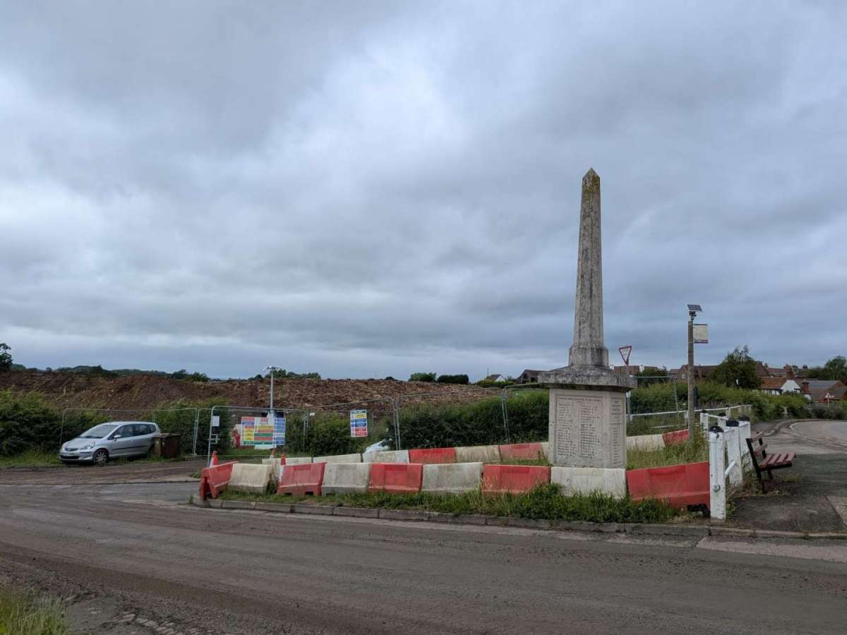
Land at (OS 8563 4427) Church Lane Severn Stoke: Construction of permanent flood defence for the village of Severn Stoke with associated earthworks.
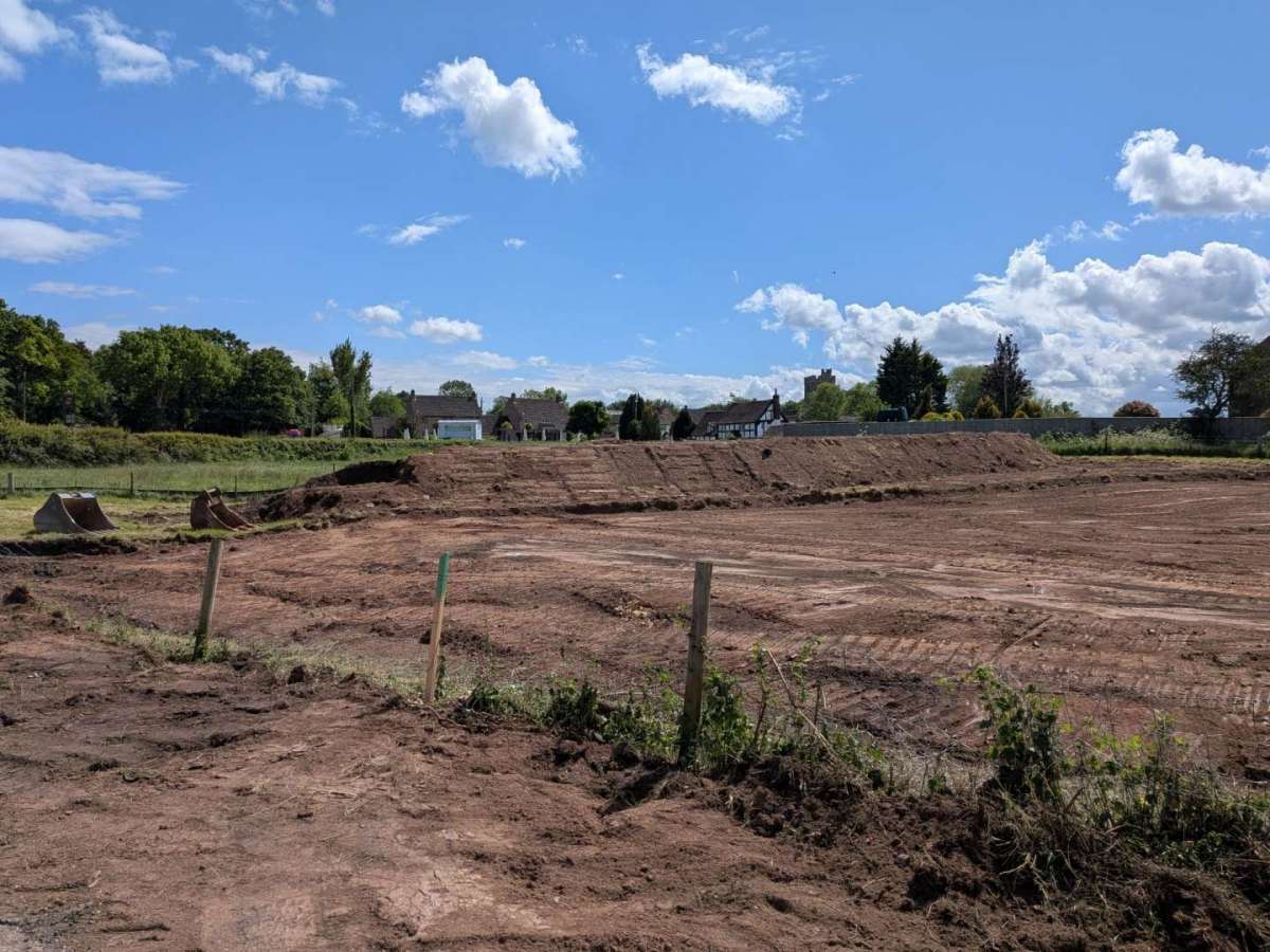
Government funding was announced to allow the delivery of the Severn Stoke Flood Risk Management Scheme (FRMS) in January 2026. Since then, the Environment Agency, Worcestershire County Council and the contractor Alun Griffiths Construction Ltd have been working at pace to progress delivery through a collaboration. Severn Stoke has a long history of flooding from the River Severn, with the community severely impacted during recent winters. 18 properties, the local church, the local pub and the A38 have all been affected during periods of significant flooding. The scheme will consist of a flood bank that runs to the west of the village, new drainage works to manage surface water, and a section of raised road to where Ham Lane will pass over the flood bank. Some imported fill material for the flood bank is already on site and further material will be imported in the coming months. Mobilisation of the construction work started late April 2026. The aim is to completeconstruction around Christmas 2026. Residents have begun a photo diary of the progress of the bund and this can be found on the Facebook page https://www.facebook.com/groups/128213133859491/ (the Parish Council is not responsible for external content).
The Parish Council would like to express its sincere thanks to all residents who have supported and persevered in the long campaign to secure a flood bund for Severn Stoke. This has been a lengthy and often challenging process, requiring patience, determination and a shared commitment to protecting our community from the impacts of flooding. The progress made would not have been possible without the continued encouragement, engagement and resilience shown by residents over many years.
The Parish Council also recognises that achieving progress on a project of this scale requires commitment from a range of organisations and elected representatives. The advocacy, guidance and practical assistance of our MP, County and District Councillors and the Environment Agency represent valuable contributions, and we are grateful for the time and effort dedicated to supporting the scheme.
While there is still work ahead, reaching this stage is a significant achievement for the village and wider parish. The flood bund represents an important investment in the future of Severn Stoke and its ability to better withstand flood events.
 To view the original planning documents associated with this application, please visit the Malvern Hills District Council Planning Website
and search for 21/02035/FUL https://plan.malvernhills.gov.uk/ District Council Planning Website
--------------------------------------------------------------------------------------------------------------------------
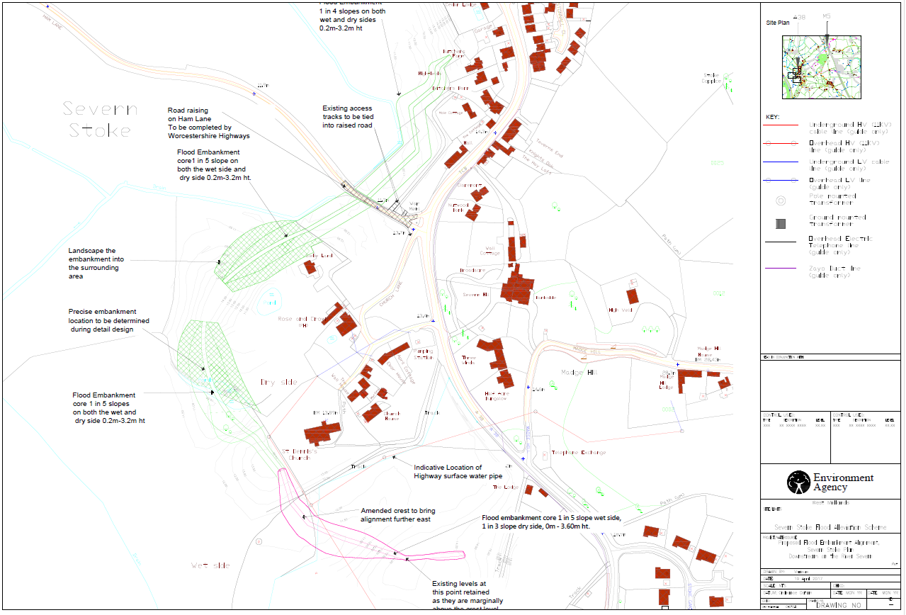
Map 1 below: Proposed_GA_Severn_Stoke_New Alignment_200723.pdf Download this document here
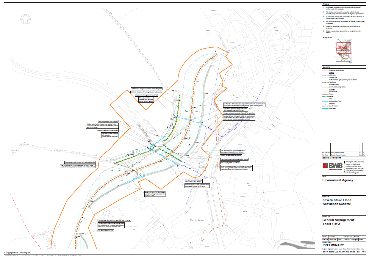
Map 2 below: SSFA-BWB-ZZ-XX-DR-CE-0023_General Arrangement_S2-P01.pdf Download this document here
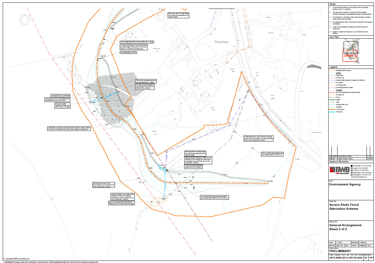
Map 3 below: SSFA-BWB-ZZ-XX-DR-CE-0024_General Arrangement_S2-P01.pdf Download this document here
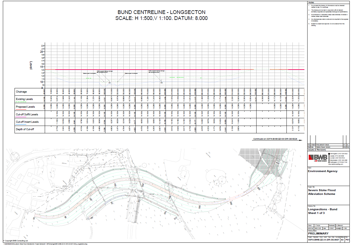
Map 4 below: SSFA-BWB-ZZ-XX-DR-CE-0027_Longsections - Bund_S2-P01.pdf Download this document here
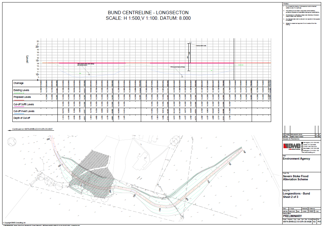
Map 5 below: SSFA-BWB-ZZ-XX-DR-CE-0028_Longsections - Bund_S2-P01.pdf Download this document here
Map 6 below: Ham Lane raising works plans. Severn Stoke FAS - Indicative Highway Raising Design - HL02.pdf Download this document here

--------------------------------------------------------------------------------------------------------------------------
 Flood watch camera: Farsons Digital Watercams.
https://www.farsondigitalwatercams.com/locations/severn-stoke-a38
Please note that the parish council is not responsible for the content of external websites.
--------------------------------------------------------------------------------------------------------------------------
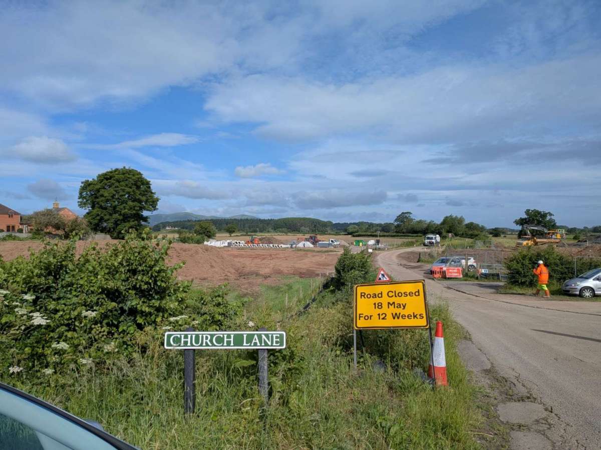
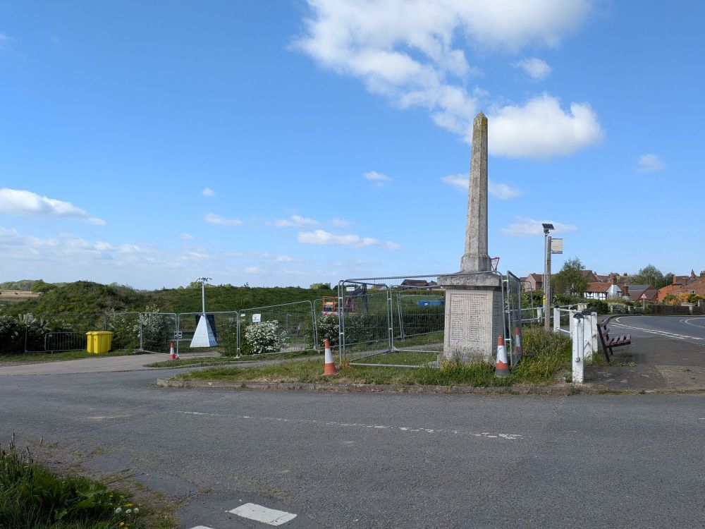
28 April 2026
Ham Lane
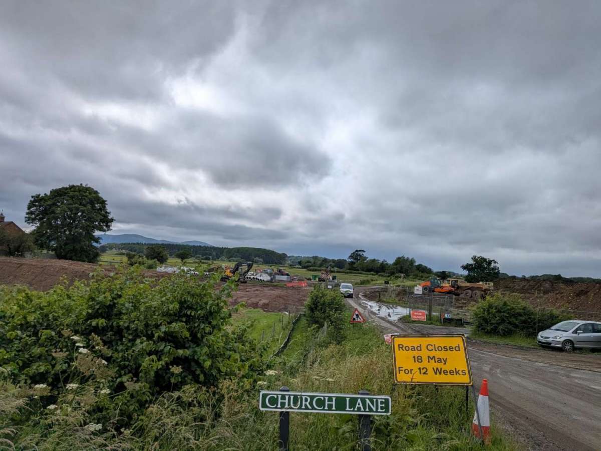
15 May 2026
Ham Lane looking towards the pub and church
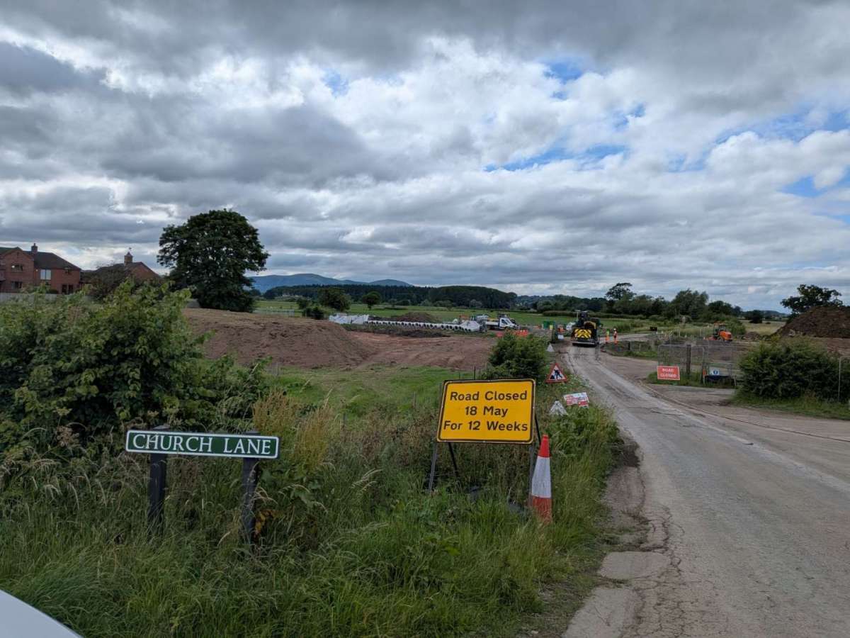
5th June 2026
Ham Lane
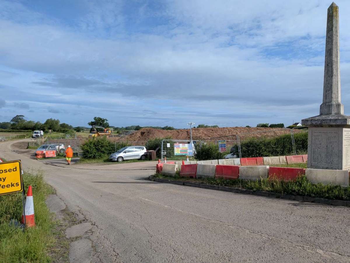
11th June 2026
Ham Lane
18th June 2026
Ham Lane
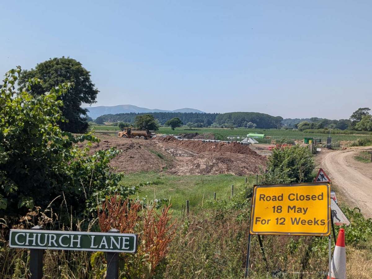
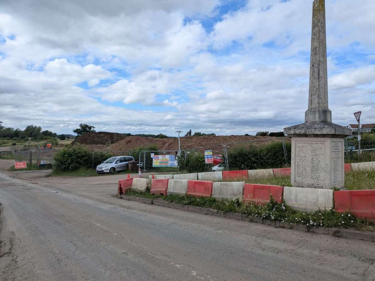
10th July 2026
Ham Lane
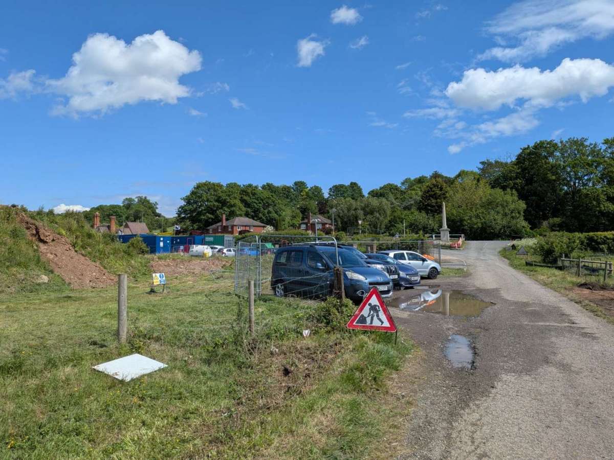
28th April 2026
Hall Site
15th May 2026
Hall Site
5th June 2026
Hall Site
11th June 2026
Hall Site
18th June 2026
Hall Site
.jpeg)
10th July 2026
Hall Site
View all press releases associated with this project:
--------------------------------------------------------------------------------------------------------------------------
Useful link to a topographical map of the Severn Stoke area:
https://en-bw.topographic-map.com/map-3zxt6/Worcestershire/?center=52.09533%2C-2.20523&zoom=13
Courtesy of topographic-map.com. Disclaimer: The Parish Council is not responsible for the content of other websites.
--------------------------------------------------------------------------------------------------------------------------
As of 16/07/2026
Importing material: From 16/07/2026 material is permitted to be imported from Upton Marina. 650 tonnes of material have been brought in so far.
Timescales: Still on track to complete earth works in September 2026.
Drainage: Drainage works continue, with 5 gangs on site, 1 gang has completed their section and has moved to assist the others.